About the App
Connectivity & Offline Packs
In the Media
Get Involved
Data & Research Sovereignty
Using The App
App Training Material
Training Videos
Surveys
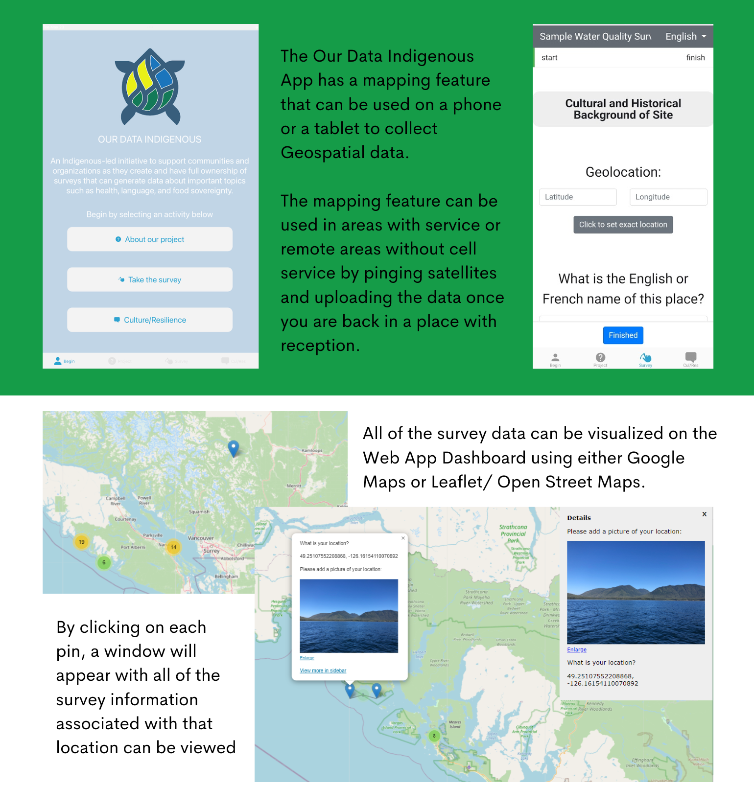
Geospatial Mapping
Who We Are
Community Partners
Funders & Partners
Contact Us
About the App
Connectivity & Offline Packs
In the Media
Get Involved
Data & Research Sovereignty
Using The App
App Training Material
Training Videos
Surveys
Geospatial Mapping
Who We Are
Community Partners
Funders & Partners
Contact Us
Geospatial Mapping
By including the Latitude and Longitude in a survey you can visualize the coordinates using Geospatial Mapping.